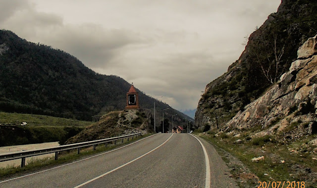
Leaving Aktash, heading northwest towards Gorno-Altaysk. It's our second day Driving on the Chuysky Trakt or M52/P256.

Some of the places we visited today as we travelled from Aktash to Onguday

Some of the places we visited today as we travelled from Aktash to Onguday
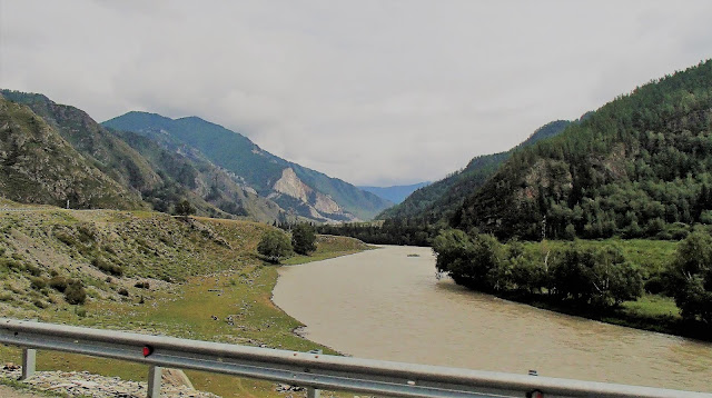
View near the village of Chibit... ~350km southeast of Gorno-Altaysk
Chuya River, a tributary of Katun River
Altai Mountain Range
Road upgrading in progress
________________________
Shirlak Waterfall
A small waterfall about 25 metres high next to the Chuysky Trakt
Handman local talisman
Our Sorento at Shirlak waterfall
________________________
Monument to Builders of Chuysky Trakt
View of Chuya Valley from a section of the Old Chuysky Trakt
A section of the Old Chuysky Trakt
Retaining wall of the Old Chuysky Trakt
________________________
Belyy Boom Village and the Monument to the Fallen in the Struggle for Soviet Power
Souvenirs stalls selling mostly Mongolian stuff such as gloves, socks etc
A local tourist curious about our travel.
Camp site at Belyy Boom
Photo with local tourist before we leave Belyy Boom
________________________
Video of our drive on the Chuysky Trakt from Aktash to Belyy-Boom
________________________
Belyy-Boom to Iodro Village
Iodro Village
________________________
Adyr-Kan Sanctuary (Ancient Chuy Deer Stone)
The ancient megalith carved from stone, known as the Chuy Deer Stone
Our simple late lunch before we leave the Deer Stone.
________________________
The Confluence of the Yaloman River and Katun River
View of the way to Inya / Yaloman.
Ininskiye Stely Balbals on old grave near Inya Village.
Clear waters of the Yaloman River
Confluence of the Yaloman River and Katun River - the point at which the clear waters of the Yaloman mixes with the brown waters of the Katun River.

Our Sorento at the Yaloman River, a popular picnic / camping spot for local tourists.

Clear and cool waters of the Yaloman River
Locals with their tents and Our Sorento at the Yaloman River.
________________________
Kupchegen
On the way to Kupchegen
Kupchegen Village
Exiting Kupchegen Village
________________________
Chike-Taman Pass
Although the pass peaks at 1,246m above sea level, it was a steep climb over winding roads to the to the top.

At the peak of Chike-Taman Pass

A memorial showing the history of the Pass that began as a horse path
The view of the valley from the peak and the road down hill...

Ovoo at the peak of Chike-Taman Pass.
We descended Chike-Taman Pass and drove along Ursul River.

Our campsite along Ursul River


No comments:
Post a Comment